Summary:
You’ve got plans. A site. A timeline. Maybe even financing lined up. But before your crew breaks ground, there’s one question that determines whether your project stays on budget or turns into a money pit: do you actually know what’s happening with that land?
A topographic survey isn’t optional for serious builders and developers in Nassau County, NY or Suffolk County, NY. It’s the foundation of every decision you’ll make about grading, drainage, foundation placement, and site layout. Without it, you’re guessing. And guessing costs money.
Here’s what you need to know about topographic surveys, when construction projects require one, and how the right elevation data keeps your project moving forward.
What a Topographic Survey Actually Tells You
A topographic survey maps the physical features of your land in three dimensions. Not just where things are horizontally, but how high or low they sit vertically.
You get precise elevation data at key points across your property. Contour lines that show slopes, peaks, valleys, and flat areas. The exact location of existing structures, mature trees, utilities, and water features. Drainage patterns that show where water flows and where it pools.
Basically, everything that affects how you can build on that site and what challenges you’ll face during construction. This is the topographic survey meaning that matters to builders: it’s a detailed map of reality before you commit to a design.
This isn’t the same as a boundary survey, which establishes property lines. A topo survey tells you what’s on the property and how the ground actually behaves. Most construction projects need both surveys working together.
How Land Elevation and Contours Impact Your Construction Plans
Elevation matters because water doesn’t flow uphill. If your site has a natural slope, you need to know which direction water moves, how fast it moves, and where it accumulates. That information determines your drainage strategy, your foundation design, and whether you’re looking at expensive grading work.
Contour lines on a topographic survey connect points of equal elevation. When those lines are close together, you’re looking at a steep slope that might require retaining walls or special foundation work. When they’re spread out, the land is relatively flat and easier to build on. Engineers use this contour data to calculate cut and fill requirements, plan access roads, and position buildings where they’ll actually work with the terrain instead of fighting it.
Let’s say you’re planning a commercial development on a 10-acre site in Nassau County, NY. Your architect has a vision, but that vision was drawn on flat paper. A topographic survey shows you the site has a 15-foot elevation change from one corner to the other, with a natural drainage swale running through the middle. Now you know you’ll need retaining walls, a comprehensive stormwater management plan, and probably some creative grading to make the parking lot function properly.
Without that land elevation survey, you find out about the elevation change when your excavation crew hits rock where you expected easy digging. Or when the first heavy rain floods your foundation excavation. Both scenarios cost exponentially more than the survey would have, plus they delay your entire schedule while you scramble for solutions.
The survey also identifies existing features that impact your design decisions. Mature trees you might want to preserve for aesthetic or environmental reasons. Utility easements you need to work around. Rock outcroppings that will add thousands to your excavation costs. Wetland areas that trigger additional permitting requirements. All of this information feeds into your planning before you commit to a final design that might need expensive changes later.
What Information Is Included in a Topographic Survey
A complete topographic survey captures both natural and man-made features across your property. On the natural side, you’re looking at elevation changes at regular intervals, existing vegetation including tree locations and sizes, bodies of water or wetlands, soil conditions where visible, and natural drainage patterns showing where water flows during rain events.
Man-made features include existing buildings with their footprints and heights, paved areas like driveways and parking lots, retaining walls and their conditions, fences and property improvements, utility poles and overhead lines, manholes and catch basins, and visible utility infrastructure above ground. If there’s something on or above the ground that could affect your construction project, it should be documented on the survey.
The level of detail depends on what you’re building and what your engineer needs. A residential addition might need a basic topo survey showing major elevation changes at two-foot contour intervals and existing structures. A commercial development typically needs contour intervals at one-foot or even six-inch spacing, plus detailed utility locations, spot elevations at key points like building corners and drainage structures, and cross-sections showing elevation changes along important sight lines.
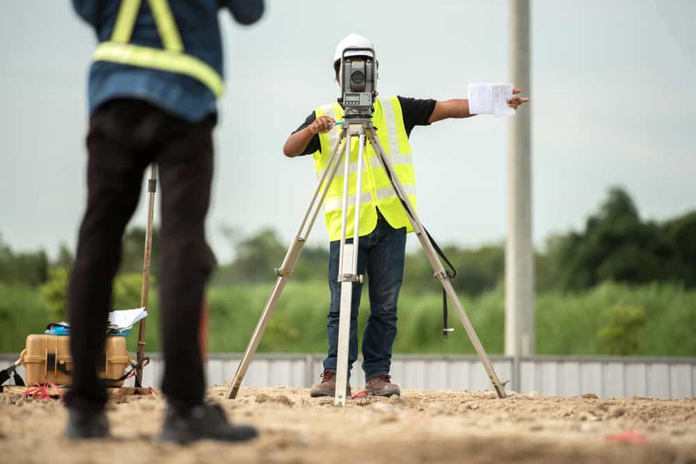
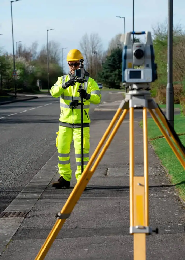
We use a combination of GPS equipment for horizontal positioning, total stations for precise elevation measurements, and sometimes drone technology to capture data across larger sites efficiently. The result is typically delivered as a CAD drawing that your engineer and architect can import directly into their design software. We also provide 3D terrain models that let you visualize the site and test different grading scenarios before you start moving dirt.
The survey establishes benchmark points with known elevations that your construction crew will reference throughout the project. These benchmarks ensure everyone—from the excavation contractor to the concrete crew to the grading contractor—is working from the same elevation data. That prevents the kind of miscommunication that leads to foundations poured at the wrong height or drainage systems that slope the wrong direction.
You’ll also see property boundaries included on most topographic surveys, even though boundary determination is technically a separate service. We combine elements of both because you need to know where your property lines are in relation to the topography. Building setbacks and zoning requirements are measured from those property lines, and you can’t position your building correctly or plan your site layout without knowing both the legal boundaries and the physical elevation data.
When Do Builders Need a Topographic Survey for Construction
The short answer is: before you design anything. The longer answer depends on what you’re building, what the site looks like, and what your local building department requires.
Any new construction project benefits from a topo survey for construction planning. You need it for site planning, grading design, drainage calculations, and foundation engineering. Most municipalities in Nassau County, NY and Suffolk County, NY require topographic surveys as part of your permit application package.
If you’re working with a site that has any kind of slope, you absolutely need a topographic survey before your architect starts designing. Flat lots are more forgiving of design assumptions. But even on sites that look relatively flat, you need to know about subtle elevation changes that affect drainage, foundation design, and accessibility compliance.

Types of Construction Projects That Require Topographic Surveys
New commercial buildings need topographic surveys to plan parking lots, loading areas, and stormwater management systems that comply with local regulations. Your civil engineer can’t design a grading plan without knowing the existing elevations and understanding how water currently moves across the site. They need to show that your development won’t create drainage problems for neighboring properties or overload the municipal storm sewer system.
Residential subdivisions require detailed topographic data for road layout, individual lot grading, and utility design. You’re not just building one house. You’re creating an entire drainage network that has to work for multiple lots while meeting county standards for road grades and stormwater management. That requires precise elevation data across the entire property, typically at one-foot contour intervals or tighter.
Site improvements like parking lot expansions, new driveways, or outdoor amenities all depend on topographic information. Even something as straightforward as adding a loading dock to an existing building requires you to know the existing grade so you can match truck bed heights and ensure proper drainage away from the building and loading area.
Any project that involves significant earthwork needs a topographic survey before you start estimating costs. Moving dirt is one of the largest variable expenses in site development. The survey lets you calculate exactly how much material you need to cut or fill, which directly impacts your budget and your schedule. Contractors who skip this step often discover they need twice as much fill as they estimated, or they encounter rock that wasn’t supposed to be there, blowing up both budget and timeline.
Drainage projects are impossible to design properly without topographic data. Whether you’re installing a new stormwater system, adding retention ponds to meet updated regulations, or just trying to fix an existing drainage problem that’s causing issues, you need to know which way water flows naturally, how fast it moves, and where it accumulates during different storm events. A topographic survey shows you the natural drainage patterns so your engineer can work with them instead of fighting against the site’s natural hydrology.
Foundation design depends on understanding the soil conditions and elevation at the specific points where your building will sit. Your structural engineer needs to know if one corner of the building sits five feet lower than another corner, because that affects the foundation design, potentially the building structure itself, and definitely your construction costs. Sloped sites might require stepped footings or deeper foundations on the low side, all of which need to be designed before you break ground.
How Topographic Surveys Prevent Costly Construction Delays and Budget Overruns
Most construction problems that blow up budgets and timelines trace back to not knowing enough about the site before you start. A topographic survey solves that problem by giving you complete, accurate information upfront when it’s still cheap to adjust your plans.
Drainage issues are probably the most common expensive surprise on construction sites. You think the site drains adequately, then the first significant rain floods your foundation excavation and you’re pumping water for days while work stops. Or you build your parking lot and discover water sheets across it toward the building instead of toward the storm drains, creating liability issues and requiring expensive regrading. A topographic survey shows you the natural drainage patterns before you design anything, so your engineer can plan proper grading and stormwater management from the beginning.
Earthwork surprises kill budgets faster than almost anything else. You estimate you’ll need 500 cubic yards of fill material, then discover you actually need 2,000 yards because the existing grades are different than you assumed. That’s not just the cost of extra fill—it’s also the cost of hauling it in, spreading it, compacting it, and the time delay while you source additional material. Or you plan to cut the site relatively level and hit bedrock that requires blasting or special equipment you hadn’t budgeted for. Topographic surveys give you accurate existing elevations so your earthwork calculations are based on real data instead of optimistic guesswork.
Foundation problems often trace back to not understanding the site conditions during the design phase. Maybe one corner of your building sits in a low spot that collects water and has poor soil conditions. Maybe the soil type varies significantly across the site. Maybe there’s more slope than anyone realized and your foundation needs to step down in ways that weren’t in the original design. A topographic survey identifies these issues early so your foundation engineer can design accordingly and you can budget realistically.
Access and circulation problems show up when you try to fit a driveway or access road onto a site with more slope than you realized. Suddenly you need switchbacks, retaining walls, or extensive regrading that wasn’t in the budget or the schedule. The survey shows you the existing grades so you can plan realistic access routes that actually work with the topography, meet ADA requirements if applicable, and don’t require heroic engineering efforts.
Permit delays happen when you submit plans based on incomplete or inaccurate information. The building department reviews your grading plan and realizes it doesn’t match the actual site conditions, or your drainage calculations don’t account for existing slopes. Now you’re back to the drawing board, redesigning and resubmitting while your project sits idle. A proper topographic survey prevents this because your plans are based on accurate, verifiable data that the building department can check against their own records or site visits.
The cost of fixing any of these problems after construction starts is typically 10 to 20 times what the survey would have cost upfront. You’re paying for redesign work, for construction delays and idle crews, for materials that were ordered based on wrong quantities, for equipment that’s not suitable for the actual conditions, and for the ripple effects throughout your schedule as every trade gets pushed back. Smart builders and developers invest in good topographic surveys because they understand that information is cheaper than mistakes.
Getting Accurate Topographic Survey Data for Your NY Project
A topographic survey isn’t project overhead you’re trying to minimize. It’s the foundation of every smart decision you’ll make about site development and construction sequencing.
You need accurate elevation data to design proper drainage that protects your building and meets code requirements. You need detailed contour information to calculate earthwork costs and avoid expensive surprises when excavation starts. You need to know what’s actually on the site—and how the ground actually behaves—before you commit to a design that might not work or might cost far more than necessary to build.
The builders and developers who skip this step or try to work with outdated surveys from previous projects are the ones dealing with expensive surprises mid-construction, change orders that eat their margins, and delays that cascade through their schedules. The ones who invest in proper topographic surveys upfront are the ones whose projects stay on schedule, on budget, and free from the kind of problems that damage reputations and relationships.
If you’re planning a construction project in Nassau County, NY or Suffolk County, NY, we provide the detailed, accurate topographic surveys that builders and developers rely on to make informed decisions. With over 50 years of experience serving Long Island, we understand local conditions, regulations, and the specific challenges of building in these markets. Reach out to discuss your project and get the elevation and drainage data that keeps construction moving forward smoothly.