Summary:
Your lender just told you they need a survey before closing. Or maybe you’re planning that backyard pool and discovered the building department won’t issue a permit without one. Perhaps there’s confusion about where your property line actually sits, and you need documentation before a small disagreement with your neighbor turns into something bigger. Whatever brought you here, you’re trying to figure out what a land survey costs in Nassau or Suffolk County—and why quotes seem to vary so much. The price isn’t fixed because every property is different. Your lot size, terrain, the type of survey you need, and how quickly you need results all affect what you’ll pay. Here’s what actually drives land survey costs on Long Island and what you should expect when you hire a surveyor.
What Drives Land Survey Costs in Nassau and Suffolk County
Most residential land surveys in Nassau County, NY and Suffolk County, NY cost between $600 and $1,500. That’s the typical range for a standard boundary survey on a residential lot, but your specific property determines where you’ll land in that range.
Property size is the biggest factor. A quarter-acre lot in Garden City costs less to survey than a two-acre property in Huntington. Larger properties mean more boundary lines to measure, more corner markers to locate or set, and more time spent in the field documenting everything.
Terrain complexity matters just as much. A flat, rectangular lot with clear sight lines is straightforward work. A wooded property with steep slopes, dense vegetation, or irregular boundaries takes significantly longer. If our survey crew needs to clear brush to take measurements or navigate difficult terrain, that extra time shows up in your final bill.
How Lot Size and Shape Affect Survey Pricing in NY

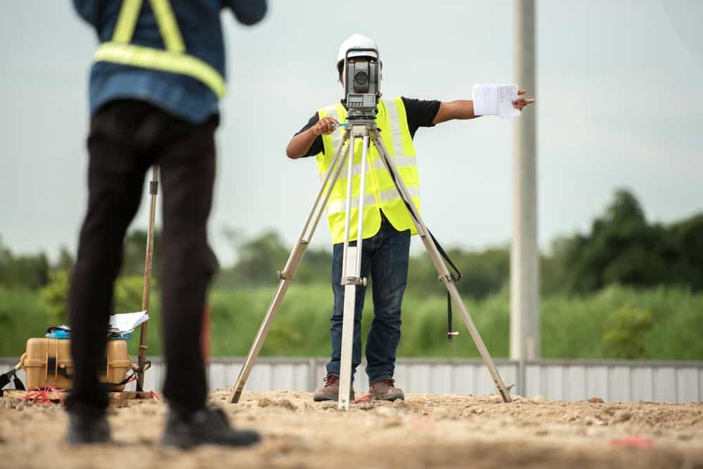
When we quote your job, we’re estimating how long it takes to research property records, locate existing boundary markers, take precise measurements, and produce a legally defensible survey report. Property size directly impacts that timeline.
A typical suburban lot under half an acre might require one to two days of fieldwork. Larger properties—especially those over an acre—need multiple days on site. We walk the entire perimeter, locate or set corner markers at each property corner, measure distances and angles, and document structures, fences, and improvements in relation to boundary lines.
Lot shape affects complexity too. A simple rectangular parcel with four corners is easier to survey than an irregularly shaped property with multiple angles and boundary lines. More corners mean more measurements, more calculations, and more potential complications if old survey markers are missing or if historical records conflict with physical evidence on the ground.
Properties with unusual configurations cost more to survey. Pie-shaped lots, flag lots, or parcels that wrap around other properties require additional time to verify each boundary line. We need to match current measurements against deed descriptions, locate monuments or markers that might be decades old, and resolve any discrepancies before certifying the boundaries.
If your Long Island property hasn’t been surveyed in years, expect additional research time. Old deed descriptions often reference landmarks that no longer exist—”the old oak tree” or “the stone wall” that disappeared decades ago. Boundary markers may have been removed during landscaping, buried under pavement, or destroyed. We need to reconstruct boundaries using historical records, adjacent property surveys, and mathematical calculations, which adds time and cost.
Nassau and Suffolk County properties often have complicated histories. Many were subdivided multiple times over generations. Each subdivision created new boundary lines, and if previous surveys weren’t perfectly accurate, small errors compound over time. We need to trace your parcel’s history through county records, compare multiple documents, and resolve discrepancies before we can establish accurate property lines.
Why Terrain and Property Conditions Change Survey Costs
Terrain complexity is one of the biggest variables in land survey cost. A flat, open lot with good visibility is the easiest and least expensive to survey. Our crew can move quickly, sight lines are clear, and measurements are straightforward.
Wooded properties in Suffolk County present different challenges. Dense vegetation blocks sight lines and makes it harder to locate existing property markers. Our crew might need to clear brush to take accurate measurements, which adds time. Steep slopes, rocky terrain, and uneven ground slow down fieldwork and require more careful measurements to ensure accuracy.
If your property includes water features, wetlands, or sits in a flood zone, we need to document those conditions. That might require an elevation certificate showing your property’s relationship to FEMA flood maps, especially if you’re in coastal areas of Nassau County or near Long Island Sound. Elevation certificates typically add $150 to $600 to your survey cost but can lower flood insurance premiums significantly.
Accessibility affects pricing too. If your property is difficult to reach—down a long private road, or without clear vehicle access—we need extra time just to get equipment on site. Travel time from our office also factors in, though we don’t charge separately for local travel within Nassau and Suffolk County.
Weather and season matter. Winter land surveys cost more in New York because snow and ice obscure boundary markers and create hazardous conditions for field crews. Dense summer foliage can block sight lines in wooded areas, though fall surveys after leaves drop often provide better visibility and easier working conditions.
The condition of existing property records plays a major role. If your property has clear, recent documentation with accurate legal descriptions, we can work efficiently. But if records are outdated, incomplete, or conflicting—common with older Long Island properties—the research phase takes longer. We might need to visit the Nassau or Suffolk County clerk’s office in person, track down historical surveys from previous owners, or interpret deed descriptions written before modern surveying technology existed.
Types of Land Surveys and What Each One Costs
The type of survey you need directly affects the cost. A basic boundary survey for a fence installation costs less than a comprehensive ALTA survey for a commercial real estate transaction.
Boundary surveys are the most common for residential properties in Nassau County, NY and Suffolk County, NY. They establish your property lines, locate or set corner markers, and document any encroachments or easements. This is what you need for building permits, fence installation, pool construction, or most real estate transactions. Expect to pay $600 to $1,000 for a standard boundary survey on a typical residential lot under one acre.
Topographic surveys cost more because they document elevation changes, natural features, slopes, and terrain details. These are often required for construction projects where grading, drainage, or site planning matters. If you’re building an addition, installing a septic system, or planning significant landscaping work, you might need a topographic survey. These typically run $750 to $1,500 depending on property size and complexity.

Boundary Survey vs ALTA Survey Cost in New York
If you’re involved in a commercial real estate transaction, refinancing, or your lender requires more detailed documentation, you might need an ALTA survey. These follow strict national standards set by the American Land Title Association and provide comprehensive information about boundaries, easements, improvements, utilities, zoning compliance, and encroachments.
ALTA surveys cost significantly more than standard boundary surveys because they require extensive research and documentation. We need to verify information with title companies, review all recorded easements and deed restrictions, document all improvements and their distances from property lines, identify utility locations, and ensure the survey meets specific ALTA/NSPS standards. In Nassau and Suffolk County, ALTA surveys typically cost $1,200 to $4,000 or more depending on property size and complexity.
For most residential property owners on Long Island, a standard boundary survey is sufficient. Your lender, title company, or attorney will tell you if they require something more comprehensive. If you’re planning a residential fence, pool, deck, or addition, a boundary survey provides what you need at a lower cost.
Mortgage surveys—sometimes called location surveys—are less detailed and less expensive, usually $200 to $700. They show the location of improvements relative to apparent property lines but aren’t suitable for construction purposes or resolving boundary disputes. Many title companies in New York require full boundary surveys rather than accepting mortgage surveys, so verify requirements before ordering to avoid paying twice.
Some situations require specialized surveys. If you’re subdividing property, you’ll need a subdivision survey showing how the parcel will be divided. If you’re in a flood zone, you might need just an elevation certificate rather than a full survey. If there’s a boundary dispute with a neighbor, you’ll want a boundary survey that can hold up in court if necessary.
Rush Survey Costs and Timeline Considerations
If you need results quickly, expect to pay a premium. Standard land surveys take five to ten days for most residential properties in Nassau and Suffolk County. That timeline includes research time to review property records and historical surveys, fieldwork to locate markers and take measurements, office time to analyze data and prepare drawings, and final review to ensure accuracy.
Rush surveys are possible, but they cost 15 to 25 percent more than standard rates. If you need results in two to five days, we have to rearrange our schedule, prioritize your project over others already in progress, and potentially work overtime or bring in additional crew members to meet your deadline.
Rush fees exist because surveying requires careful preparation and can’t be rushed without affecting other clients. Each project needs research into county property records, coordination with field crews, and time for quality control. When you request expedited service, we put other projects on hold, which affects our workflow and commitments to other property owners.
Planning ahead saves money. If you know you’ll need a survey for a real estate closing or construction project, order it as early as possible. Give us two to three weeks if your property is large, complex, or hasn’t been surveyed recently. That allows time for thorough research and fieldwork without rushing, and you avoid premium charges for last-minute requests.
Timing matters for other reasons too. If you’re buying or selling property in Nassau or Suffolk County, the survey needs to be current. Most title companies require surveys completed within the last six to twelve months. An old survey from a previous owner might not be acceptable, even if you have a copy. Changes to the property—new structures, removed fences, altered landscaping, or neighboring construction—can affect boundaries and make older surveys outdated or inaccurate.
If you’re planning construction, coordinate your survey with project timelines. You need survey results before applying for building permits in most cases. Nassau and Suffolk County building departments typically require surveys showing that your planned improvements comply with setback requirements, don’t encroach on easements or utility rights-of-way, and stay within your property boundaries. Starting construction without a survey risks permit rejection, work stoppages, and expensive corrections.
Planning Your Land Survey Budget for Long Island Property
Land survey costs in Nassau County, NY and Suffolk County, NY typically range from $600 to $1,500 for residential properties, with your final price depending on lot size, terrain complexity, survey type, and timing. That investment protects you from expensive boundary disputes, ensures compliance with local building requirements, and provides legally defensible documentation that holds up in court if questions arise.
Whether you’re buying, selling, building an addition, installing a pool, or resolving a property line question, getting an accurate survey upfront costs far less than dealing with disputes, permit rejections, or construction delays later. A survey that costs $1,000 today prevents legal battles that can cost tens of thousands down the road.
When you’re ready to move forward with your Long Island property survey, we bring over five decades of experience serving Nassau and Suffolk County with accurate, reliable surveys at competitive rates and faster turnaround times.