
Summary:
You’ve got a project in mind — maybe a pool, an addition, or a full build — and someone along the way told you that you need a topographical survey. Now you’re trying to figure out what that actually means, how long it takes, and whether the firm you’re calling actually knows Nassau County’s permitting maze or is just hoping for the best.
That’s a fair concern. This page is here to answer the real questions: what a topographical survey covers, when you genuinely need one, and what the process looks like from start to finish. No jargon, no runaround — just the information you need to move forward confidently.
What Is a Topographical Survey and What Does It Actually Show?
A topographical survey — sometimes called a topo survey or elevation survey — maps the physical characteristics of a piece of land. That means contour lines showing elevation changes, spot elevations at key points, drainage patterns, existing structures, trees, utilities, driveways, and property lines. The result is a detailed, three-dimensional picture of your property as it actually exists in the real world.
This is different from a boundary survey, which focuses strictly on legal property lines. A topographical survey goes further — it captures the shape and features of the land itself. Most construction and engineering projects need both, but the topographic data is usually what your architect or civil engineer will rely on to design drainage systems, grade your lot, or position a new structure correctly.
In New York State, these surveys must be performed and sealed by a licensed land surveyor. That’s not optional — it’s the law under Article 145 of the Education Law, and a survey from an unlicensed party has no legal standing.
Getting a Survey of Your Property: What the Process Actually Looks Like
Most people have never been through this before, so there’s a lot of uncertainty about what actually happens between your first phone call and the moment you receive the finished survey. Here’s how it works.
It starts with a consultation — a conversation about your property, your project goals, and what the survey needs to accomplish. If you’re pulling a permit in the Town of Hempstead versus a village like Garden City or Rockville Centre, the requirements can differ. Nassau County’s 64 incorporated villages and three towns each have their own building departments, setback rules, and documentation standards. We ask the right questions upfront and save you from having to redo work later.
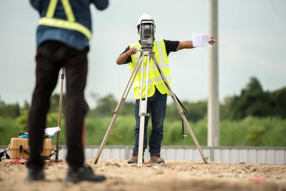
From there, our field crew goes out to your property. They establish survey control points tied to known benchmarks, locate and stake all lot corners, and then systematically collect elevation data and feature locations across the entire site. For a typical residential lot in Nassau County, fieldwork takes a few hours — though larger or more complex properties take longer. The crew maps everything: structures with finish floor elevations, trees with approximate diameter, driveways, fences, drainage swales, and utilities at the surface level.
Once fieldwork is complete, the data gets processed and drafted into a final survey document — typically delivered as both a PDF and an AutoCAD (.DWG) file so your architect or engineer can work directly with it. Our average turnaround from fieldwork to delivery is eight days. That’s not a vague promise — it’s the operational standard we hold ourselves to, because we know you often have a contractor waiting or a permit deadline approaching.
The final document includes contour lines (usually at two-foot intervals for residential properties), spot elevations, all mapped features, property lines, and the supervising licensed surveyor’s seal. That seal is what makes it legally valid and accepted by Nassau County’s building departments.
I Need a Survey of My Property — How Do I Know Which Type?
This is one of the most common questions we hear, and the confusion is understandable. There are several survey types — boundary, topographic, title, ALTA, elevation certificate — and figuring out which one applies to your situation isn’t always obvious from the outside.
The short answer: if your project involves any kind of construction, grading, drainage, or structural addition, you almost certainly need a topographical survey. If you’re buying or selling property, you likely need a title or boundary survey. If you’re in a FEMA flood zone — which covers a significant portion of Nassau County’s South Shore communities including Long Beach, Freeport, Merrick, and Oceanside — you may also need an elevation certificate, and the topographic data from your survey feeds directly into that.
Here’s a practical way to think about it. A topographical survey answers the question: what does this land look like, and how does water move across it? A boundary survey answers: where exactly does my property begin and end? Both are important, but they serve different purposes. Many projects require both, and having one firm handle both eliminates the coordination headaches of working with multiple surveyors.
One thing worth knowing: if you have an existing survey from when you bought your house, it may not be sufficient for a current permit application. Building departments in Nassau County typically want current documentation, and surveys are generally only considered reliable for five to ten years. If your survey predates any construction, additions, or landscaping work on the property, it may already be outdated for permit purposes. We perform both original surveys and updates, so if you’re not sure whether your existing survey is still usable, that’s worth a quick conversation before you assume it’ll work.
Getting a Survey of Your Property in Nassau County: What Makes It Different Here
Nassau County isn’t a simple, uniform market when it comes to land surveys. The county’s geography, regulatory structure, and post-Sandy flood zone landscape create a set of conditions that genuinely affect how topographic surveys are scoped, executed, and delivered.
If you’re working with a firm that treats Nassau County the same as everywhere else on Long Island, that’s a problem. The specifics here matter — from which building department you’re filing with to whether your property sits on the Harbor Hill Moraine’s rolling North Shore terrain or the flat, flood-prone South Shore.

Survey for House Property in Nassau County: North Shore vs. South Shore Considerations
The physical landscape of Nassau County is more varied than most people realize. The North Shore — communities like Oyster Bay, Locust Valley, Sands Point, and Great Neck — sits on the Harbor Hill Moraine, a glacial ridge that creates real elevation changes, bluffs, and complex drainage patterns. A topographical survey for a property in Oyster Bay needs to capture that terrain accurately, because the grading and drainage design for a new addition or pool on a sloped North Shore lot is meaningfully different from the same project on flat ground.
The South Shore is a different story. Communities like Long Beach, Oceanside, Freeport, Massapequa, and Wantagh are flat and low-lying — and a significant number of properties in these areas sit within FEMA Special Flood Hazard Areas. After Superstorm Sandy reshaped the flood map landscape in 2012, and again after Hurricane Ida in 2021, FEMA updated its flood zone designations across Nassau County’s coastal communities. Many homeowners found themselves in higher-risk flood zones than before, with new requirements around structure elevation and flood insurance.
For any construction project in a South Shore flood zone, your topographic survey needs to capture accurate elevation data that will support both your permit application and your elevation certificate. These aren’t separate concerns — they’re connected, and the surveyor handling your topo needs to understand how that data will be used downstream. We’ve been working across both the North and South Shore for over fifty years, and that institutional knowledge of Nassau County’s terrain isn’t something you can replicate with a new firm.
Need a Survey of My Property in Nassau County? Common Questions, Answered
**Do I need a topographical survey to pull a building permit in Nassau County?**
In most cases, yes. The Town of Hempstead, Town of Oyster Bay, and Town of North Hempstead building departments — as well as many of Nassau County’s 64 incorporated villages — require topographic survey data as part of permit applications for new construction, additions, pools, and drainage systems. The specific requirements vary by municipality. What satisfies the Town of Oyster Bay Building Department may not be identical to what Garden City’s building department requires, which is why we always verify local requirements upfront.
**How long does a topographical survey take in Nassau County?**
For a typical residential property in Nassau County, fieldwork takes a few hours. From that point, our average turnaround to final deliverable is eight days. The industry norm on Long Island runs closer to four to seven weeks — we’ve heard from plenty of homeowners who’ve experienced that firsthand. Eight days is a meaningful difference when you have a contractor scheduled or a permit deadline on the calendar.
**Can I use my old survey instead of getting a new topographical survey?**
It depends on when it was done and what’s changed on the property since. If you’re not sure, bring it to the conversation when you call us. We can assess whether an update is needed or whether the existing document will hold up.
**What does a topographical survey cost in Nassau County?**
Costs vary based on lot size, terrain complexity, and what the survey needs to accomplish. New York’s market typically runs higher than national averages. The best way to get an accurate number for your specific property is to request a quote — ours are free and come with no obligation.
Working With a Nassau County Land Surveyor Who Actually Knows the Area
A topographical survey isn’t something most homeowners think about until they need one — and when you do need one, you usually need it quickly. Whether you’re pulling a permit in Syosset, planning a pool in Massapequa, or navigating flood zone requirements in Long Beach, the quality and speed of your survey can directly affect your project timeline.
The right surveyor knows Nassau County’s municipalities, understands the terrain differences across the county, and delivers work that your building department, architect, and engineer can actually use. That combination of local knowledge, technical accuracy, and fast turnaround is what makes the difference between a project that moves and one that stalls.
We’ve been serving Nassau and Suffolk County for over fifty years, with an eight-day average turnaround and a 5-star Google rating built on consistent, reliable work. If you’re ready to get started or just want to understand what your project requires, reach out to us for a free, no-obligation quote.