

Summary:
Someone told you that you need a survey. Maybe it was your lender, your contractor, your town’s building department, or your neighbor — who is now very confident that your fence is on his property. The problem is, “a survey” isn’t one thing. There are several types, and two of the most commonly confused are boundary surveys and topographic surveys. They sound similar. They’re not.
Ordering the wrong one means paying for something you can’t use — and then paying again for what you actually needed. Here’s how to tell them apart, what each one costs in Nassau County, and how to make sure you get it right the first time.
What Is a Boundary Survey and What Does It Cost?
A boundary survey establishes the legal limits of your property. It confirms exactly where your lot begins and ends based on your deed, public records, and physical measurements taken in the field. The result is a certified survey map, signed and sealed by a licensed New York State land surveyor, that shows your property corners and boundary lines in a way that courts, title companies, lenders, and municipalities will actually recognize.
In Nassau County, you can expect to pay $600 to $1,000 for a standard boundary survey on a typical residential lot under one acre. That range holds for most of the single-family homes across towns like Syosset, Garden City, Westbury, and Roslyn. More complex properties — irregular lots, waterfront parcels, or anything with unresolved easements — can push that number higher.
Property Line Survey Cost: What Affects the Price in Nassau County
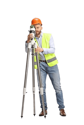
Lot size is the single biggest cost driver for a property line survey. The larger the parcel, the more time it takes to measure, research, and certify — and time is what you’re paying for. But in Nassau County, size isn’t the only variable that matters.
The age of your property’s records plays a significant role. A large portion of Nassau County’s housing stock was built during the post-WWII boom of the 1940s through 1960s. Many of those properties haven’t been formally resurveyed since. When existing records are incomplete, outdated, or difficult to locate, the surveyor has to do more legwork before a single measurement is taken in the field — and that adds to the cost.
Terrain and vegetation matter too. A flat, cleared residential lot in Hempstead is faster to work than a wooded or sloped parcel in Oyster Bay. Properties near the water — Long Beach, Atlantic Beach, Bayville — often carry additional complexity because of flood zone designations, tidal boundaries, and FEMA-related requirements that don’t apply to inland lots.
One thing Nassau County property owners sometimes overlook is how dense the residential landscape actually is. Most lots here are under a quarter acre. When your house, your neighbor’s house, and the property line between them are separated by a matter of feet, precision isn’t optional — it’s the entire point. A few inches of measurement error can mean a fence, a driveway extension, or a shed addition is legally sitting on someone else’s land. That’s the kind of problem a boundary survey exists to prevent before it becomes a dispute, not after.
Finally, if a property hasn’t been surveyed in decades, the surveyor may need to locate or reset corner monuments — the physical iron pins that mark boundary points in the ground. Recovering or replacing those adds time and, in some cases, cost. It’s not a surprise fee — it’s just part of doing the job right.
When Do You Actually Need a Boundary Survey?
The most common triggers are fence installations, additions, permit applications, and real estate transactions. If your town’s building department is requiring a survey before issuing a permit, a boundary survey is almost always what they’re asking for. Nassau County municipalities take setback requirements seriously — the distance your structure must sit from the property line is regulated, and they need a certified survey to confirm compliance before they’ll approve anything.
If you’re buying or selling a home, your lender or title company may require a current survey as a condition of closing. Here’s something that catches a lot of Nassau County buyers off guard: the survey from when the previous owners bought the house is often not acceptable. If it’s more than a few years old, or if any structures have been added since it was done, the lender may require a fresh one. That’s not a technicality — it’s because the property’s physical condition may have changed in ways the old survey doesn’t reflect.
Neighbor disputes are another common driver. If someone is claiming your fence, driveway, or landscaping crosses onto their property — or if you believe theirs crosses onto yours — a boundary survey is the only way to settle it with documentation that holds up. Opinions and old paperwork don’t resolve those conversations. A certified survey map does.
What a boundary survey does not do is map the elevation or physical features of your land in a way that engineers and architects can use for design work. If you’re planning a construction project that involves grading, drainage, or site planning, you’re likely looking at a different product entirely.
Topographic Survey Cost: What You're Paying for and Why It's Different
A topographic survey — sometimes called a topo survey — maps the physical characteristics of your land. That means elevation changes, slopes, contour lines, trees, utility lines, structures, and any other features that sit on or affect the surface of the property. The output is a detailed map that engineers and architects use to design buildings, plan drainage, and prepare construction documents.
In Nassau County, topographic surveys typically run $750 to $1,500 for a standard residential property. The range is wider than boundary surveys because the scope of work varies more — a flat quarter-acre lot in Levittown is a very different job from a sloped, wooded parcel in Glen Cove with drainage concerns and multiple existing structures.

House Survey Explained: Where Topographic Surveys Fit In
When homeowners use the phrase “house survey,” they usually mean one of two things: either a mortgage survey done for a real estate closing, or a survey connected to a construction project on an existing home. Understanding which one you’re actually describing matters, because the survey type — and the cost — will be different.
For a real estate closing, what lenders and title companies typically want is a boundary-based survey that confirms the property lines, identifies structures, and flags any encroachments or easements. That’s a mortgage or title survey, which is closely related to a standard boundary survey in scope.
For a construction project — an addition, a pool, a major renovation — a topographic survey is often what your architect or engineer needs before they can design anything. They need to know the slope of the land, where water drains, how the existing structures sit relative to grade, and what the contour of the site looks like. A boundary survey tells them where the property ends. A topo survey tells them what the land inside those boundaries actually does.
In some cases, you need both. A pool installation in a Nassau County backyard, for example, might require a boundary survey for the permit application and a topographic survey for the engineering and drainage plan. Knowing that upfront — rather than discovering it mid-project — is exactly the kind of thing that saves you from paying for the same work twice.
The good news is that a licensed surveyor can tell you within minutes of reviewing your project which survey type applies to your situation. The mistake most homeowners make is assuming they already know, ordering without asking, and ending up with a certified document that doesn’t serve the purpose they needed it for.
Cost of House Survey in Nassau County: A Practical Breakdown
Nassau County is not a cheap market for real estate, and surveying costs reflect that — but not in the dramatic way national cost guides suggest. When you search for land survey costs online, you’ll find national averages that range from $475 to well over $5,000. Those numbers aren’t wrong, but they’re not particularly useful if you’re trying to budget for a property in Mineola or Massapequa.
For a standard residential boundary survey in Nassau County, the realistic range is $600 to $1,000. For a topographic survey on a typical residential lot, expect $750 to $1,500. Those figures reflect what the local market actually looks like — not a rural parcel in upstate New York, and not a commercial development in Manhattan.
What moves the number higher in Nassau County specifically? Waterfront and coastal properties carry a premium because of the additional complexity involved — flood zone classifications, tidal boundaries, and FEMA requirements add scope to the work. Properties with older or incomplete deed records require more research time before fieldwork can begin. And any project that involves both a boundary and a topographic survey — which is more common than most homeowners expect — will carry a combined cost that reflects both scopes of work.
One thing worth understanding about New York State: only a licensed land surveyor can certify a boundary survey. That’s not a formality — it’s a legal requirement. A survey signed and sealed by a licensed NYS land surveyor is the only version that lenders, courts, building departments, and title companies will accept. If someone is offering you a significantly cheaper alternative, it’s worth asking whether the result will actually be usable for your intended purpose.
Turnaround time also factors into the equation differently than most buyers expect. In Nassau County’s active real estate market, delays can push back closings or permit timelines in ways that cost more than the survey itself. Working with a surveyor who can deliver in 5 to 8 business days — rather than several weeks — has real value when you’re working against a deadline.
Which Survey Do You Need — and What's the Right Next Step?
The short version: if you need to establish legal property lines, resolve a dispute, or satisfy a permit or closing requirement, you need a boundary survey. If you’re planning construction and your engineer or architect needs to understand the physical characteristics of your land, you need a topographic survey. And if you’re not sure, the answer is to ask before you order — not after.
Nassau County properties come with their own set of variables: dense lots, aging records, coastal complexity, and active municipal enforcement. Getting the right survey type from the start isn’t just about saving money — it’s about making sure the work you commission is actually usable for what you need it to do.
If you’re ready to move forward or just want to know which survey applies to your situation, we at Islandwide Land Surveyors have been serving Nassau County homeowners and commercial property owners for over 50 years. Reach out for a free, no-obligation quote — and get a straight answer before you spend anything.