Summary:
If you’ve ever had a permit delayed, a fence dispute with a neighbor, or a closing held up over a survey question, you already know how much accuracy matters. What you might not know is that the method your surveyor uses makes a real difference in what you get back.
RTK GPS surveying has become the standard for professional land surveying — and for good reason. But a lot of homeowners and developers in Nassau County still aren’t sure what it means, why it matters, or whether it applies to their project. This page answers those questions plainly, so you can make a smarter call when it counts.
What Is RTK GPS Surveying and How Does It Actually Work?
RTK stands for Real-Time Kinematic. It’s a GPS-based surveying method that achieves centimeter-level accuracy — typically within 1 to 2 centimeters — by using two components working together: a fixed base station and a mobile rover unit carried by the surveyor in the field.
The base station sits at a known reference point and continuously monitors satellite signals. As it detects errors caused by atmospheric interference or satellite orbit variations, it broadcasts real-time corrections to the rover. The rover applies those corrections on the spot, which means we know exactly how accurate each data point is before we leave the site. No waiting. No post-processing. No return trips to fix mistakes caught later in the office.
How Does RTK GPS Compare to Traditional Land Surveying Methods?

Traditional surveying relies on optical instruments — total stations, theodolites, and measuring chains — to establish angles and distances between known points. These methods have been refined over decades and remain useful in certain conditions, particularly where heavy tree canopy or dense urban structures block satellite signals. But for the majority of residential and commercial survey work in Nassau County, they’ve been largely replaced by RTK GPS for one simple reason: precision.
Standard consumer GPS — the kind on your phone — has an error margin of 3 to 5 meters. That’s not remotely useful for determining a property line. Traditional optical survey methods are more accurate than that, but they depend on clear sightlines, multiple crew members, and careful manual measurements that introduce their own margin for error. RTK GPS cuts that error down to 1 to 2 centimeters. That’s roughly the width of your thumb. In Nassau County’s densely packed neighborhoods — where properties in Garden City, Hewlett, or Syosset sit close together with shared fences and tight setbacks — that level of precision isn’t a luxury. It’s a necessity.
There’s also the efficiency factor. Traditional methods often require a surveyor to return to a site if a measurement error is discovered during office processing. RTK GPS validates data in real time, in the field. If something looks off, it gets corrected before the crew packs up. That’s a direct reason why we maintain an average turnaround time of 8 days — a specific operational result of using the right technology, not just a marketing claim.
Another difference worth understanding: older GPS survey methods like static GPS require hours of observation time at each point, followed by extensive post-processing back at the office. RTK GPS delivers the same quality of result in a fraction of the time. For a homeowner trying to get a permit application in front of the Town of Hempstead or the Village of Garden City on a schedule, that speed matters.
What Land Survey Types Use RTK GPS — and Which One Do You Need?
RTK GPS isn’t limited to one kind of survey. It’s the underlying technology behind most modern field data collection, which means it applies across the full range of land survey types a property owner or developer might need.
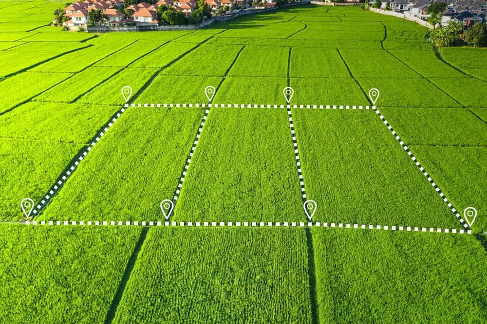
Boundary surveys use RTK GPS to establish precise property corners and confirm the lines described in your deed. If you’re planning a fence in Massapequa, adding a pool in Plainview, or building an addition in Roslyn, this is typically the first survey required before a permit application goes anywhere. The centimeter accuracy of RTK GPS means the corners we set are defensible — legally and practically.
Topographic surveys map the elevation and contour of a site, capturing the shape of the land for design and planning purposes. These are common for new construction, drainage planning, and site development. RTK GPS collects elevation data quickly and accurately, which is especially relevant along Nassau County’s South Shore, where even small elevation differences can affect drainage patterns and FEMA flood zone determinations.
Flood elevation certificates require precise vertical elevation measurements of a structure’s lowest floor relative to the base flood elevation. For homeowners in flood-prone communities like Freeport, Baldwin, or Long Beach, the accuracy of that elevation reading can directly affect your flood insurance premium. A small vertical error in the wrong direction could cost you hundreds of dollars a year. RTK GPS removes that uncertainty.
Construction surveys stake building corners, utility routes, and road alignments before and during construction. For residential projects — a new garage, a pool, a home addition — RTK GPS allows a single surveyor to set layout points quickly and accurately without the full crew setup traditional methods require. For larger commercial or municipal projects, the same technology scales up without a drop in precision.
Update surveys, which are performed when a prior survey already exists, also benefit from RTK GPS because the control network established during the original survey can be re-occupied precisely. We perform both original and update surveys, which means the data stays consistent across time and the results hold up when they need to.
Surveying Engineering: How RTK GPS Fits Into Civil Engineering and Construction Projects
RTK GPS isn’t just for residential property lines. It’s the same technology used on highway construction, bridge positioning, and large-scale infrastructure projects. In surveying engineering, the ability to collect precise spatial data in real time — and feed it directly into design software — has transformed how projects are planned and built.
For developers and engineers working in Nassau County, this matters at every stage. From initial topographic mapping to construction layout to as-built documentation, RTK GPS provides a continuous, reliable data thread that keeps projects on track and on spec.

How Is RTK GPS Used in Surveying in Civil Engineering Projects?
In civil engineering, surveying isn’t a one-time task at the start of a project — it runs alongside the work from site assessment through final inspection. RTK GPS integrates into that workflow at multiple points, and the efficiency gains are significant.
During the design phase, topographic surveys using RTK GPS give engineers accurate elevation and contour data to work from. That data shapes grading plans, drainage design, utility routing, and building placement. When the underlying survey data is accurate to within centimeters, the design built on top of it is more reliable — and the gap between what was designed and what gets built is smaller.
During construction, RTK GPS is used for layout work: positioning building corners, setting stakes for utility trenches, aligning road grades. For this kind of work, RTK GPS replaces the traditional total station and rod person setup for most open-area tasks. One surveyor with a rover unit can move through a site efficiently, setting points with verified accuracy rather than manually measuring distances from a fixed instrument. On a large residential development or a municipal infrastructure project in Nassau County, that efficiency translates directly into schedule and cost savings.
The technology also supports machine control systems, where RTK GPS data drives excavators, graders, and dozers to design grade automatically. While this is more common on large infrastructure jobs, it illustrates how deeply RTK GPS has become embedded in the civil engineering workflow — it’s not a specialty add-on, it’s the backbone of how modern construction sites are managed.
For developers and engineers working with surveying firms in Nassau County, the practical question is whether the firm you hire has the equipment and experience to deliver data that integrates cleanly with your engineering workflow. RTK GPS output is compatible with the CAD and GIS platforms most engineers use, which means less time reformatting data and more time working with it.
Why Nassau County Projects Specifically Benefit From RTK GPS Precision
Nassau County presents a specific set of conditions that make survey precision more important here than in many other markets — and that make the choice of surveying firm more consequential than homeowners often realize.
The county is governed by three towns — Hempstead, North Hempstead, and Oyster Bay — plus two cities and 64 incorporated villages, each with its own zoning codes, setback requirements, and permit processes. A boundary survey that’s accurate enough for one municipality may not satisfy the requirements of another. Knowing the difference between what the Village of Mineola requires and what the Town of Oyster Bay expects isn’t something you learn from a manual — it comes from years of working in the county. We’ve been doing this since 1970. That institutional knowledge, combined with RTK GPS accuracy, is what actually protects your project from getting kicked back.
The North Shore and South Shore also present different surveying conditions. The North Shore’s glacial moraine geology — the rolling hills and rocky terrain you find in Oyster Bay, Locust Valley, and Glen Cove — requires surveyors who know how to work around natural obstacles while maintaining control accuracy. The South Shore’s flat, low-lying coastal plains, particularly in communities like Freeport, Oceanside, Merrick, and Massapequa, sit in FEMA flood zones where elevation data needs to be exact. RTK GPS handles both environments reliably, but experience with the specific terrain matters.
Property values in Nassau County consistently rank among the highest in New York State. When the median home price exceeds $600,000, a boundary error that misplaces a property line by even a few feet isn’t a minor inconvenience — it can trigger a legal dispute that costs far more to resolve than the survey cost in the first place. The precision RTK GPS provides is, in a very real sense, protection for your investment.
For anyone working near the Nassau-Queens border — in Valley Stream, Elmont, or Floral Park — the complexity compounds further, because surveys may need to satisfy requirements from multiple jurisdictions. We serve Nassau, Suffolk, and Queens Counties, so cross-county projects don’t require coordinating between separate firms or worrying about whether your surveyor knows the territory on both sides of the line.
Choosing the Right Surveyor in Nassau County, NY: What to Ask Before You Hire
The method your surveyor uses matters. RTK GPS surveying delivers a level of accuracy and efficiency that traditional methods simply can’t match for most residential and commercial projects — and in a county as dense, regulated, and high-value as Nassau County, that difference shows up in real outcomes: permits approved, closings completed, disputes avoided.
When you’re evaluating surveying firms, ask directly whether they use RTK GPS, how long their typical turnaround runs, and how long they’ve been working in your specific county. Those three questions will tell you most of what you need to know.
We’ve been surveying properties across Nassau and Suffolk County since 1970, and we use current-generation RTK GPS equipment on every applicable project. If you have a survey coming up — whether it’s a boundary survey, a flood elevation certificate, a construction layout, or anything in between — reach out to us. We’re based in Syosset and we know Nassau County well.