
Need a clear picture of your property boundaries? Islandwide Land Surveyors provides professional surveying services in Wantagh.
Reviews
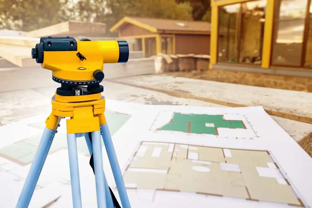
Land Surveyor in Wantagh, NY, Nassau County
Meet the Islandwide Land Surveyors Team
At Islandwide Land Surveyors, we’re not just your average surveying company; we’re your advisors in property lines and land development. Our team in Nassau County combines experience with technology to create success for every project. We’re focused about understanding your land, whether you’re a homeowner with a boundary dispute, a developer planning a new project, or a business owner looking to expand, and building lasting relationships with our clients.

The Surveying Process


The Value of Professional Surveying
For any property owner in NY, a professional land survey is a detailed roadmap for your land, revealing boundaries, elevations, and risks that you might not see right away, making our service imperative. At Islandwide Land Surveyors, we offer your property surveying services in Wantagh, including boundary surveys, topographic surveys, and construction surveys to make sure they can guide you towards cost-effective and productive results. Contact us at 516-496-7822 to schedule for your land ownership.
The Wantagh area was inhabited by the Merokee (or Merikoke) tribe of the Metoac Indians prior to the first wave of European settlement in the mid-17th century. The Merokee were part of the greater Montauk tribe that loosely ruled Long Island’s Native Americans. Wantagh was the sachem (chief) of the Merokee tribe in 1647, and was later the grand sachem of the Montauk tribe from 1651 to 1658. The Dutch settlers came east from their New Amsterdam colony, and English settlers came south from Connecticut and Massachusetts settlements. When the English and Dutch settled their competing claims to Long Island in the 1650 treaty conducted in Hartford, the Dutch partition included all lands west of Oyster Bay and thus the Wantagh area. Long Island then was ceded to the Duke of York in 1663-64, but then fell back into Dutch hands after the Dutch regained New York in 1673. The Treaty of Westminster in 1674 settled the land claims once and for all, incorporating Long Island into the now-British colony of New York.
Early settler accounts refer to Wantagh as “Jerusalem”. The creek running north-south through Wantagh, and which has been covered up in many places but is still visible between the Wantagh Parkway and the housing developments west of Wantagh Avenue, was originally the Jerusalem River. The original post office was built in 1837, for Jerusalem, but mail service from Brooklyn began around 1780. The town’s first school was established in 1790. At some time around the 1880s, Jerusalem was renamed Ridgewood, and the town’s original LIRR station was named “Ridgewood Station”. Later, Ridgewood was renamed Wantagh to avoid confusion with another town in New York State with the same name.
George Washington rode through Jerusalem on April 21, 1790, as part of his 5-day tour of Long Island. The Daughters of the American Revolution have placed a plaque on Hempstead Turnpike to commemorate Washington’s travels, which took him from Hempstead on Jerusalem Road (now North Jerusalem Road) to Jerusalem, on to Merrick Road. He then went on to head east, then circle back west on the north shore. During the Revolutionary War, British ships traveled up Jones inlet and came ashore to raid Jerusalem farms.
Learn more about Wantagh.